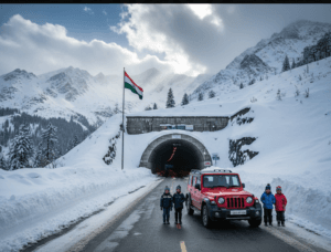
Vaishno Devi Height from Sea Level

Vaishno Devi Height from Sea Level & Kasauli Elevation – Colonial Charm Hill Station
A practical, SEO-friendly guide to Vaishno Devi’s elevation and Kasauli height from sea level — climate, trekking notes, travel tips and quick comparison tables for easy planning.

Vaishno Devi cave shrine high in Trikuta Hills and Kasauli’s tree-lined colonial ridge — elevations that shape weather and travel.
Vaishno Devi Height from Sea Level-
Overview: Why elevation matters for pilgrims & hill-station lovers
Altitude affects everything from temperature and snowfall to how the human body responds during a trek. For pilgrims visiting Vaishno Devi and travelers seeking the gentle colonial charm of Kasauli, knowing the precise heights — and what those heights mean practically — helps plan safer, more comfortable trips. Below we unpack the Vaishno Devi height from sea level, multiple facts about Kasauli elevation, climate patterns, trek details, and travel tips to make your journey smooth.
Quick Facts: Elevation Snapshot
| Place | Elevation (approx.) | Why it matters |
|---|---|---|
| Vaishno Devi (Bhawan / Holy Cave) | ≈ 1,584–1,615 m (≈ 5,200–5,300 ft). | Moderate altitude trek; cooler temperatures than plains; plan for 13 km uphill pilgrimage from Katra. |
| Kasauli (town average) | ≈ 1,800–1,900 m (≈ 5,900–6,234 ft). | Pleasant temperate climate, ideal for weekend getaways, colonial architecture and gentle walks. |
Elevations compiled from official shrine data and local geographic references. :contentReference[oaicite:6]{index=6}
Vaishno Devi Height from Sea Level — What pilgrims should know
The holy cave shrine of Vaishno Devi sits in the Trikuta Hills, with the Bhawan (the main shrine) at approximately 1,584 metres (≈ 5,200 ft) above sea level according to the shrine board and official resources. The traditional trek from Katra to the Bhawan is close to 12–13 kilometres one way (depending on the route), and pilgrims climb steadily from the base town of Katra — which itself is at a much lower elevation.
Vaishno Devi Height from Sea Level – How elevation affects the Vaishno Devi trek
- Temperature: Expect cooler temperatures at the shrine; mornings and evenings can be chilly even in summer.
- Effort required: The uphill path is steady — fitness helps, but the route is well-serviced with rest houses, ponies, palkis and battery-operated vehicles for the elderly.
- Health tips: Stay hydrated, pace yourself, and use breaks to avoid undue strain — altitude is moderate but persistent exertion can tire beginners.
Practical points: wear comfortable walking shoes, carry light layers, and book darshan slots (or check queues) during peak festivals like Navratri when visitor numbers surge. The shrine board publishes altitude and distance charts for each stop along the trek — use them to track progress.
Kasauli Elevation – Colonial charm at a comfortable height
Kasauli, in Solan district of Himachal Pradesh, is a small cantonment town perched on a ridge of the Lower Himalayas. Most geographic references list Kasauli’s elevation around 1,800 metres (≈ 5,900 ft), while some local records and maps note variations between 1,850–1,900 m depending on the spur or cantonment zone. :contentReference[oaicite:9]{index=9}
Why Kasauli’s elevation makes it ideal for a quick escape
- Mild summers: The 1,800 m elevation keeps summer temperatures comfortable (often mid-20s °C) — great for day hikes and open-air cafes.
- Chilly winters: Winters are cool and may dip to near-freezing; occasional light snow is possible on higher spurs.
- Forest walks: Pine and oak trails, Gilbert Trail and Monkey Point provide easy walking routes without extreme altitude strain.
Kasauli’s easy topography (compact town along a ridge with several spurs) and colonial-era architecture make it a low-effort hill station compared to higher, more remote destinations. Visitors frequently enjoy sunrise views, quiet cafes, and heritage bungalows while experiencing the benefits of altitude without aggressive acclimatisation demands.
Side-by-side comparison: Vaishno Devi vs Kasauli (elevation perspective)
| Aspect | Vaishno Devi (Bhawan) | Kasauli (town) |
|---|---|---|
| Approx. elevation | ≈ 1,584 m (≈ 5,200 ft). :contentReference[oaicite:11]{index=11} | ≈ 1,800–1,900 m (≈ 5,900–6,234 ft). :contentReference[oaicite:12]{index=12} |
| Best season | Year-round pilgrimages; spring & autumn preferred for pleasant weather. | March–June (spring/summer) and Sept–Nov (autumn) for clear skies and walks. |
| Accessibility | Trek from Katra (12–13 km); assisted options available (palki, ponies, battery vehicles). | Road access from Chandigarh/Delhi; nearby railway at Kalka with toy train to Shimla (optional route). |
Practical travel tips related to altitude
- Pace yourself: For Vaishno Devi, the trek is long but moderate — take rest stops and use services for older pilgrims.
- Dress in layers: Both places can cool quickly after sunset — a light jacket or fleece is handy.
- Hydrate: Especially during exertion on the Vaishno Devi trek, regular fluids keep you functioning well.
- Book ahead: Weekends and festivals fill accommodation in Kasauli; Vaishno Devi sees peak crowds during Navratri and summer holidays.
- Local advice: Consult shrine board updates for Vaishno Devi (weather & access), and cantonment notices in Kasauli for events or restrictions. :contentReference[oaicite:13]{index=13}


1 thought on “Vaishno Devi Height from Sea Level”