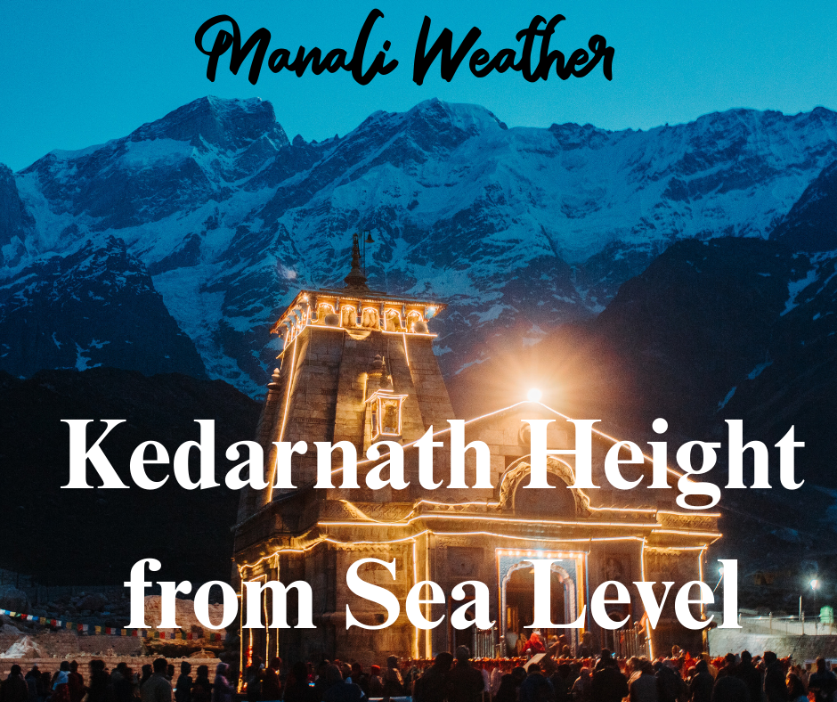
Kedarnath Height from Sea Level

Kedarnath Height from Sea Level — Pilgrimage at High Altitude
Everything you need to know about Kedarnath height from sea level, Kedarnath elevation, and how the high altitude shapes the pilgrimage experience.

Kedarnath Height from Sea Level — the key number
Kedarnath town and the famous Kedarnath Temple sit at approximately 3,583–3,584 metres (≈ 11,755–11,758 feet) above sea level. This high Kedarnath elevation places the shrine well into the alpine zone of the Garhwal Himalaya and makes the journey a true high-altitude pilgrimage. :contentReference[oaicite:0]{index=0}
Quick facts table
| Metric | Detail |
|---|---|
| Kedarnath elevation (town/temple) | ≈ 3,583–3,584 m above sea level. :contentReference[oaicite:1]{index=1} |
| Nearest motorable road head | Gaurikund — about 16 km of trek or pony/palanquin from here. :contentReference[oaicite:2]{index=2} |
| Temple open season | Typically open April/May (Akshaya Tritiya) to November (Kartik Purnima) — closed in heavy winter. :contentReference[oaicite:3]{index=3} |
Why the altitude matters for pilgrims
The Kedarnath altitude changes everything about the pilgrimage: the weather can flip rapidly, oxygen is noticeably thinner compared with the plains, and acclimatisation becomes important for walkers. The shrine’s alpine setting brings spectacular views of glacier-fed peaks and the Mandakini river valley — but it also means visitors must prepare mentally and physically for steep climbs, cold nights, and variable conditions. :contentReference[oaicite:4]{index=4}
Altitude effects — what to expect
- Breathlessness on exertion: Expect a faster pulse and heavier breathing on steep sections until you acclimatise.
- Temperature swings: Even in summer, nights can be near freezing close to the temple; layers are essential.
- Sun & UV: Solar radiation is stronger at higher altitudes — use sunglasses and sunscreen.
- Seasonal access: Heavy snowfall and avalanche risk close the temple in winter; most pilgrims visit between spring and autumn. :contentReference[oaicite:5]{index=5}
Trek, access & logistics
The classic approach to Kedarnath starts at Gaurikund (last motorable point). From Gaurikund, the traditional trek to the temple is roughly 16 km on a well-trodden mountain trail. Alternatives include pony/palanquin (subject to availability and physical suitability) or a helicopter service to nearby helipads during the season. The high elevation means weather delays are possible — plan some schedule flexibility. :contentReference[oaicite:6]{index=6}
Elevation vs experience — quick comparison
| Aspect | At Kedarnath (~3,584 m) | At lowland temples |
|---|---|---|
| Oxygen level | Noticeably lower — mild altitude effects possible | Normal; no altitude effects |
| Weather variability | Rapid shifts, snow risk; pack for cold | More stable & predictable |
| Scenery | High Himalayan peaks, glaciers, alpine meadows | Often forested or plain landscapes |
Climate change, glaciers & the long-term picture
The Chorabari Glacier above Kedarnath — the Mandakini’s source — has been retreating in recent years, a trend monitored by scientific institutes. Glacial retreat and changing precipitation patterns affect runoff, trail conditions and the region’s risk profile; this environmental context matters for the future safety and sustainability of high-altitude pilgrimage. Visitors should be mindful of ecological sensitivity and follow official guidance. :contentReference[oaicite:7]{index=7}
Preparation checklist for high-altitude pilgrimage
- Allow time to acclimatise (walk slowly, take breaks).
- Pack layered clothing, waterproof outer shell, warm hat and gloves.
- Carry water, light snacks, and sunscreen; sunglasses recommended.
- Consult local health advice if you have respiratory or heart conditions.
- Book helipad/pony/palanquin services in advance in peak season if needed. :contentReference[oaicite:8]{index=8}
Conclusion — altitude is part of the pilgrimage
The Kedarnath height from sea level (≈ 3,583–3,584 m) is not just a statistic — it defines the pilgrimage’s character: demanding, scenic, and deeply atmospheric. Respect for high-altitude conditions, careful preparation, and attention to seasonal and environmental guidance will help make the journey safe and spiritually rewarding.
Sources & further reading
- Shri Kedarnath Dham (official site) — temple altitude & info.
- Kedarnath — location, elevation and access details (Wikipedia).
- Trek & logistics guides — typical trekking distance and seasonal notes.
- Times of India — reports on Chorabari glacier retreat and regional risks.
Darjeeling Height from Sea Level
Delhi Height from Sea Level


2 thoughts on “Kedarnath Height from Sea Level”