Kasol Height from Sea Level

Kasol Height from Sea Level
A practical, travel-ready guide to Kasol height from sea level, Kasol elevation, and why Kasol’s altitude makes it the perfect backpacker base — with context from Badrinath’s lofty height.

Kasol Height from Sea Level — The Basics
Kasol is a small village in the Parvati Valley of Kullu district, Himachal Pradesh, known for its riverside cafés, trekking routes and relaxed backpacker culture. The commonly cited figure for the Kasol elevation is about 1,580 metres (≈5,180 feet) above sea level, which gives Kasol its cool, fresh climate and makes it a comfortable high-altitude stop without the challenges of very high Himalayan towns. :contentReference[oaicite:0]{index=0}
Quick Elevation Table — Kasol & Nearby Spots
| Place | Approx. Height | Notes |
|---|---|---|
| Kasol (village) | ≈ 1,580 m / 5,180 ft | Backpacker hub on the Parvati River. :contentReference[oaicite:1]{index=1} |
| Manikaran (hot springs) | ≈ 1,760 m / 5,774 ft | Short drive from Kasol; higher by valley steps. :contentReference[oaicite:2]{index=2} |
| Kheerganga (trek endpoint) | ≈ 2,960 m / 9,711 ft | Popular overnight trek from Barshaini/Kasol; much higher altitude. :contentReference[oaicite:3]{index=3} |
| Badrinath (for context) | ≈ 3,100 m / 10,170 ft | High Himalayan pilgrimage town — very different altitude experience. :contentReference[oaicite:4]{index=4} |
What Kasol’s Altitude Means for Travellers
At around 1,580 m, Kasol sits comfortably in the lower Himalaya band. That altitude delivers cooler daytime temperatures than the plains, crisp mornings, and evenings that often require a layer or two — but it rarely causes severe altitude sickness for most healthy visitors. This sweet spot is why Kasol is a backpacker favourite: it combines mountain atmosphere with easy accessibility and a mild acclimatisation profile compared with higher treks and passes. :contentReference[oaicite:5]{index=5}
Why Backpackers Choose Kasol
- Accessible altitude: Comfortable elevation that’s cooler than the plains but not extreme.
- Trailhead to treks: Gateways to Kheerganga, Tosh, Malana — altitude gains available for those who want them. :contentReference[oaicite:6]{index=6}
- Scenic river setting: The Parvati River adds riverside walks and camping options.
- Easy acclimatisation: Excellent base for slow-altitude ascents to higher trails like Kheerganga. :contentReference[oaicite:7]{index=7}
Kasol Climate & Best Time to Visit
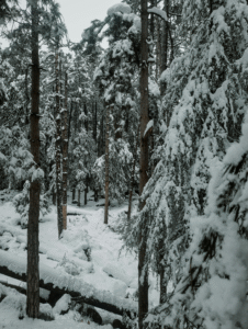
The Kasol elevation shapes a pleasant climate from March to June — ideal for escaping summer heat. Monsoon (July–September) makes the valley lush but slippery on trails; autumn (October–November) is clear and great for photography. Winters are cold and quieter; snow may fall at higher nearby spots while the village itself sees cool, crisp conditions. Plan according to whether you want trekking, chill café culture, or fewer crowds. :contentReference[oaicite:8]{index=8}
Safety, Acclimatisation & Practical Tips
Most visitors do not experience serious altitude issues at Kasol’s height, but when you plan uphill treks (Kheerganga and beyond) you will gain altitude quickly — so follow sensible acclimatisation: ascend gradually, rest at intermediate stops, hydrate, and avoid heavy exertion on day one. If you have heart or lung conditions, consult a doctor before high-altitude treks. :contentReference[oaicite:9]{index=9}
Packing Checklist for Kasol (Altitude-aware)
- Layered clothing (day tee, fleece, windproof shell)
- Good trekking shoes or shoes with grip for monsoon
- Sunscreen & sunglasses (higher UV at altitude)
- Water bottle / hydration pack and basic first-aid
- Light sleeping liner/blanket for camps or budget stays
Badrinath — High Himalayan Context
To give perspective on altitude within the wider Himalaya, Badrinath — a sacred pilgrimage town in Uttarakhand — sits well above 3,000 metres (commonly cited ≈3,100 m), a very different environment from Kasol. Badrinath’s high elevation results in thinner air, colder weather and a stronger need for acclimatisation and high-altitude preparedness than what’s required for Kasol. If your trip includes both regions, expect dramatic climate and logistical changes as you cross altitude zones. :contentReference[oaicite:10]{index=10}
Kasol Elevation — Quick Comparison Table
| Location | Approx. Altitude | Visitor Implication |
|---|---|---|
| Kasol (village) | ~1,580 m / 5,180 ft | Comfortable mountain base; cafes & trails nearby. :contentReference[oaicite:11]{index=11} |
| Kheerganga (trek) | ~2,960 m / 9,700 ft | High trek endpoint — colder, requires more acclimatisation. :contentReference[oaicite:12]{index=12} |
| Badrinath (pilgrimage town) | ~3,100 m / 10,170 ft | High-altitude pilgrimage — thin air, strong mountain climate. :contentReference[oaicite:13]{index=13} |
Final Thoughts for Backpackers
Kasol’s height from sea level (≈1,580 m) is one of its greatest strengths: high enough to deliver mountain atmosphere, yet low enough to remain welcoming and accessible. Whether you want riverside relaxation, easy treks, or to use Kasol as a staging point for higher hikes, the altitude supports a flexible, backpacker-friendly experience. If your itinerary also includes high Himalayan sites like Badrinath, plan for significant altitude and weather differences and take acclimatisation seriously.


