Height of Dharamshala from Sea Level
Height of Dharamshala from Sea Level & Rohtang Pass Elevation — Adventure at India’s High Mountain Pass
A complete guide to Rohtang Pass height from sea level, Rohtang Pass elevation, and how Dharamshala height from sea level compares — weather, travel tips and quick facts for visitors.
Quick Facts — Elevation at a Glance
| Rohtang Pass (Leh–Manali Highway) | ≈ 3,978 m / 13,050 ft above sea level. |
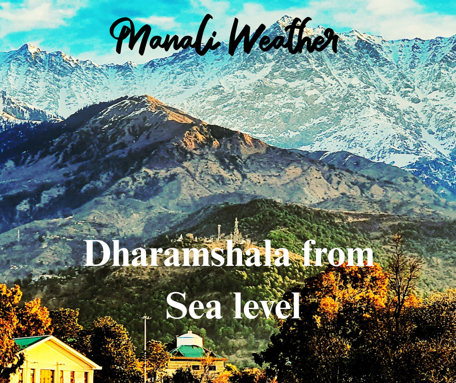
| Dharamshala (town average) | ≈ 1,457 m / 4,780 ft above sea level (Upper/Lower areas vary). |
| Rohtang range | Part of the Pir Panjal range; natural gateway from Kullu Valley to Lahaul & Spiti. |
Sources: official and travel references for elevation values. See the Sources section at the end for links.
What is the Rohtang Pass height from sea level?
The commonly accepted Rohtang Pass elevation is approximately 3,978 metres (13,050 feet) above sea level. This high mountain pass sits on the eastern edge of the Pir Panjal range and serves as the climatic and geographic divide between the lush Kullu Valley and the cold, rain-shadowed Lahaul–Spiti region. The altitude means Rohtang is frequently snowbound for large parts of the year and delivers crisp alpine air and dramatic ridge views for visitors. :contentReference[oaicite:0]{index=0}
Why this altitude matters for travellers
At nearly 4,000 metres, the Rohtang pass altitude affects weather, road access, oxygen levels and activity choice. Snow is common from late autumn through spring; summer months open up the pass but the weather can turn quickly. Trekkers and adventure tourists visit for snow sports, glacier views, high-mountain photography and an authentic ‘alpine’ experience close to Manali. Because the pass is so high, road openings are seasonal — always check the status before planning. :contentReference[oaicite:1]{index=1}
Height of Dharamshala from Sea Level — what to expect
By contrast, Dharamshala elevation (the town) is around 1,457 metres (4,780 feet) above sea level on average, though the city is split between lower commercial areas and higher zones such as McLeod Ganj and Upper Dharamshala which sit noticeably higher. This difference in altitude explains why Dharamshala’s climate is milder and more settled compared to Rohtang’s alpine extremes. :contentReference[oaicite:2]{index=2}
Dharamshala vs Rohtang — a quick comparison
| Feature | Dharamshala (~1,457 m) | Rohtang Pass (~3,978 m) |
|---|---|---|
| Typical climate | Mild to cool; monsoon-influenced | Alpine; cold year-round, heavy snow in winter |
| Best season | Mar–Oct | May–Oct (road-dependent), winter for snow sports (access limited) |
| Visitor tips | Comfortable walking; cultural & spiritual tourism (McLeod Ganj) | Warm layers, check vehicle permits, acclimatise if trekking |
Travel & safety — altitude-aware tips for Rohtang
- Check road & weather status — Rohtang is seasonally closed and regulated by permits; open windows vary each year. :contentReference[oaicite:3]{index=3}
- Dress in layers and carry waterproofs — alpine weather changes fast.
- For day trips from Manali, bring warm clothing, water, and snacks; altitude can cause mild breathlessness for some visitors.
- If you plan high-altitude activities beyond Rohtang (treks into Lahaul–Spiti), acclimatise properly and consider local guides.
Rohtang Pass elevation — activities & seasonal highlights
When Rohtang is open in summer, it becomes a hub for snow-related fun even in warmer months — snow slides, short skiing sessions, photography and high-altitude picnics. In winter, the pass is mostly snowbound but draws specialist winter sports and experienced mountaineers. Always plan with current local advisories. :contentReference[oaicite:4]{index=4}
Summary — Why elevation matters
The Rohtang Pass height from sea level (~3,978 m) creates an alpine environment — extreme weather, snow and high-mountain vistas — while places like Dharamshala (≈1,457 m) offer a milder, settled hill-station experience. Both are classic Himalayan destinations, but they serve different tastes: Rohtang for high-altitude adventure and dramatic landscapes; Dharamshala for culture, calm and accessible mountain scenery.
Planning a trip? For live weather, road status and seasonal updates across Himachal, check ManaliWeather.com — especially before driving to Rohtang or heading into higher passes.
Target keywords: rohtang pass height from sea level, rohtang pass elevation, rohtang pass altitude, rohtang pass above sea level, rohtang pass height, dharamshala height from sea level, dharamshala elevation
Sources
- Rohtang Pass — elevation and details (Wikipedia). :contentReference[oaicite:5]{index=5}
- Rohtang Pass — travel & access notes (Thrillophilia). :contentReference[oaicite:6]{index=6}
- Rohtang Pass — elevation & coordinates (Himalayan Wonders). :contentReference[oaicite:7]{index=7}
- Dharamshala — town elevation and local topography (Wikipedia). :contentReference[oaicite:8]{index=8}
- Topographic overview — Dharamshala elevations (Topographic Map). :contentReference[oaicite:9]{index=9}
Dharamshala Height from Sea Level Gangtok Height from Sea Level